
−20 m · Stone · Maya Ruins · Quintana Roo
Xaman Há Ruins: The Ancient Maya Port Beneath Modern Playa del Carmen
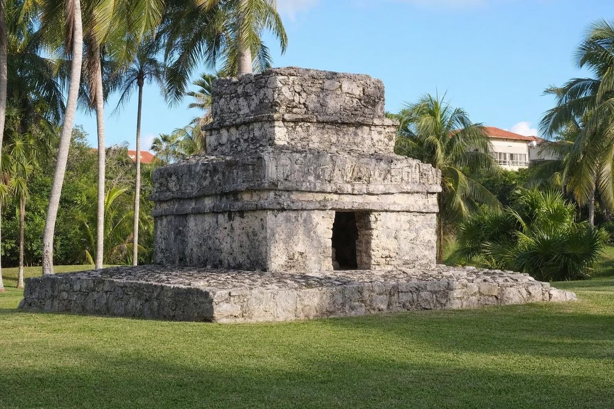
Xaman Há was the ancient Maya port on the site of today's Playa del Carmen, on the Caribbean coast of Quintana Roo. Its name means "water of the north", and in the centuries before the Spanish conquest it was one of the places where pilgrims and traders set out by canoe for the island of Cozumel. The Xaman Há ruins that survive are small temples and shrines scattered through the Playacar residential area, just south of the town's ferry pier.
The Maya port of Xaman Há
The east coast of the Yucatán peninsula was densely settled in the Late Postclassic period, roughly 1200 to 1550. Towns such as Tulum, Xel Há, P'olé (now Xcaret) and Xaman Há were linked by footpaths and by sea, and their temples doubled as landmarks for canoe pilots threading through gaps in the reef. Xaman Há, facing Cozumel across a channel about 20 km wide, was one of the natural crossing points.
The island was the home of an important shrine to Ix Chel, the goddess linked to the moon, childbirth, weaving and medicine. Women from across the Maya region came to Cozumel to pray for children and for safe births, and the ports along the mainland coast were where they waited for good weather and the right moment to cross. Traders also made the trip, since Cozumel was a hub of the canoe commerce that ran around the peninsula between the Gulf coast and Honduras.
The canoes were dugouts cut from single tree trunks, some of them large. On his fourth voyage in 1502, Christopher Columbus met a Maya trading canoe off the Bay Islands of Honduras, described by his son as long as a galley and carrying cotton cloth, copper tools, cacao beans and other goods, with a crew of paddlers and passengers under a palm-leaf shelter. Vessels of that kind worked the whole coast, including the stretch off Xaman Há.
The archaeological evidence fits this picture. Excavations in the Playacar area recorded several groups of Postclassic buildings, ceramics and burials, along with signs of an earlier, smaller settlement. The buildings follow the East Coast style: small temples on low platforms, narrow doorways, and walls covered in plaster and painted.
Spanish expeditions sailed past the coast in 1518 and 1519, and Francisco de Montejo passed through the area in the 1520s on his first attempt to conquer Yucatán. The population collapsed in the decades that followed, and the coast became almost empty. The modern fishing village of Playa del Carmen grew up only in the twentieth century, and the resort town much later.
What remains of Xaman Há today
Most of the ancient town has disappeared under construction. What survives is a handful of small structures, preserved within the Playacar development, a gated residential and hotel area on the south side of Playa del Carmen.
The shrines in Playacar
The best-known remains are a few small temples standing on lawns and in green spaces between streets and villas. Each is a single small room on a platform, built of rough limestone blocks with a narrow doorway. Traces of plaster, and in places of red paint, survive on some walls. They are modest, but they give a clear idea of the coastal style also seen at Tulum and Xcaret.
The coast itself
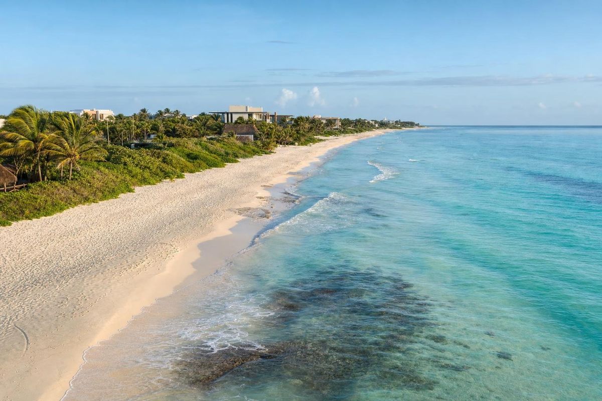
The setting explains the site better than the stones do. Standing on the beach south of the ferry pier, Cozumel is a low line on the horizon. On clear days the island looks close, but the channel has strong currents running north, which made the crossing dangerous for paddled canoes and explains why pilgrims waited and prayed before leaving.
The crossing to Cozumel, then and now
Each year in May, a re-enactment of the canoe crossing known as the Travesía Sagrada Maya takes place on this coast. Teams of paddlers in wooden canoes leave the mainland at dawn, cross the channel to Cozumel and return the next day, accompanied by ceremonies. The event began in the 2000s as a cultural project and has grown into a regional celebration. Dates and viewing arrangements change each year, so check locally.
On Cozumel itself, the shrine sites survive in much better shape. The ruins of San Gervasio, the island's main ceremonial center, are covered on the page about Cozumel's Maya ruins. The deity carved upside down over doorways along this coast, often called the Descending God, has its own page under the Descending God.
Finding the ruins
The structures lie inside Playacar, entered from the south end of Playa del Carmen near the ferry terminal. Access for pedestrians has varied over the years, and security at the gates may ask where you are going. Walking or cycling in during the day is the usual approach. There is no ticket office or visitor center, and the ruins are not signposted as a single site; asking locally, or looking at a map of Playacar's green areas, helps.
Some structures stand on hotel grounds and are only visible to guests. Respect private property and do not climb on the buildings.
When to go and practical notes
- Mornings are cooler and quieter. The lawns around the shrines offer little shade at midday.
- The dry season, roughly December to April, is the most comfortable. Hurricane season runs from June to November.
- Sargassum seaweed can pile up on this coast, mostly from spring to autumn. It does not affect the ruins, but it affects the beaches.
- Bring water and sun protection. Mosquitoes appear around green areas after rain.
For other sites along this coast, see the Maya ruins section and Muyil, south of Tulum. From the beach in front of Playacar, the ferries to Cozumel can be watched crossing the same channel the canoes once did, drifting north with the current as they go.
Xaman Há questions
What does Xaman Há mean?
It is usually translated as "water of the north", from the Yucatec Maya words for north and water.
Where are the Xaman Há ruins?
In the Playacar residential area at the south end of Playa del Carmen, Quintana Roo, a short walk from the Cozumel ferry pier.
Are the Xaman Há ruins worth visiting?
They are small, so they suit visitors already in Playa del Carmen who want to see the town's Maya past. For larger sites, Tulum and Cobá are within easy reach.
What was the link between Xaman Há and Cozumel?
Xaman Há was one of the mainland ports from which Maya pilgrims, many of them women, crossed by canoe to Cozumel to visit the shrine of the goddess Ix Chel.
Is there an entrance fee for Xaman Há?
There has been no ticket office at the scattered shrines, but access to Playacar depends on the rules at its gates, which change. Ask locally.
Nearby on the map
AI-generated image Museums · Quintana Roo
Frida Kahlo Museum
AI-generated image Beaches · Quintana Roo
Punta Esmeralda
AI-generated image Maya Ruins · Quintana Roo
Xcaret (P'olé)
AI-generated image Beaches · Quintana Roo
Grand Coral