
−5 m · Shallows · Lakes & Rivers · Quintana Roo
Bacalar Lagoon: Things to Do on the Lake of Seven Colors in Mexico
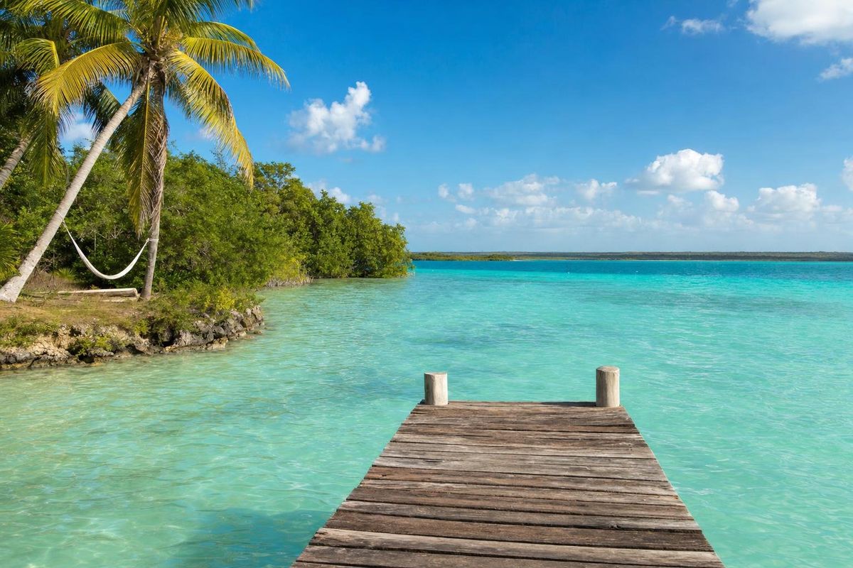
Bacalar is a small lakeside town in the far south of Quintana Roo, about 40 km north of Chetumal and close to the Belize border, built along a narrow freshwater lagoon whose water runs from almost white to deep indigo. Most visitors to Bacalar Mexico come for the water itself: swimming off wooden jetties, paddling over sinkholes, floating past stromatolites and taking a boat down the old pirate channel. The town is quiet, the hotels are mostly low and thatched, and the lake is a reliable alternative when sargassum seaweed fills the Caribbean beaches.
Why Bacalar is called the lagoon of seven colors
The nickname is old and widely used in Spanish, Laguna de los Siete Colores, and it describes something physical rather than poetic. The floor of the lagoon is covered in fine, almost white carbonate sediment, the same pale limestone sand that underlies most of the Yucatán peninsula. Over that bright floor, the color of the water depends mainly on its depth. Ankle-deep shallows read as pale cream and mint, a meter or two of water turns a strong aqua, and the color darkens through turquoise and cobalt toward the drop-offs.
Then there are the cenotes. Several sinkholes open directly into the lagoon, and over them the bottom simply disappears. Cenote Negro, near the middle of the town's shoreline, and Cenote Azul, at the southern edge of town beside the highway, are commonly given depths of around 90 meters. Seen from the air or from the ramparts of the fort, they are dark navy patches inside the bright bands. Counting exactly seven colors is a matter of light and patience; on a cloudy day the bands flatten into gray-green, and on a clear morning there are far more than seven.
The water is fresh, warm for most of the year and noticeably cooler near the cenote mouths, where groundwater rises from below. It is also unusually clear, because the lagoon sits on porous limestone with no rivers carrying silt into it. That clarity is fragile. After very heavy rain in 2020, parts of Lake Bacalar turned murky and brownish for months, an episode that local researchers linked to runoff, land clearing and wastewater along the shore. The colors returned, but the event is a good reason to treat the shoreline gently.
The lagoon itself is a product of the peninsula's geology. The whole region is a slab of young limestone with almost no surface rivers; rainwater sinks straight through the rock and moves underground toward the sea. In the south of Quintana Roo, a series of long, roughly parallel fault lines runs northeast to southwest, and the lagoon fills one of those depressions. That explains its shape, long and narrow like a river that never flows, and why the cenotes along its length line up so neatly.
A short history of Bacalar Mexico, from Maya port to pirate target
The lagoon was settled long before the Spanish arrived. The Maya name usually given for the place is Bak'halal, often translated as "surrounded by reeds," and the water route from the lagoon through narrow channels to Chetumal Bay made it a natural link in canoe trade along the coast. The Maya city of Ichkabal, with some of the largest early platforms in the region, lies in the forest roughly 40 km to the west, and the smaller sites of Oxtankah, Kohunlich and Dzibanché are all within reach.
Spanish settlers founded a town here in the 1540s under the name Salamanca de Bacalar. It was remote, poorly supplied and repeatedly raided. The best-known attack came in 1642, when pirates under Diego el Mulato, a Cuban-born corsair who sailed with Dutch captains, sacked the town. Bacalar was largely abandoned for decades afterward and was resettled in the 1720s, partly with families brought from the Canary Islands.
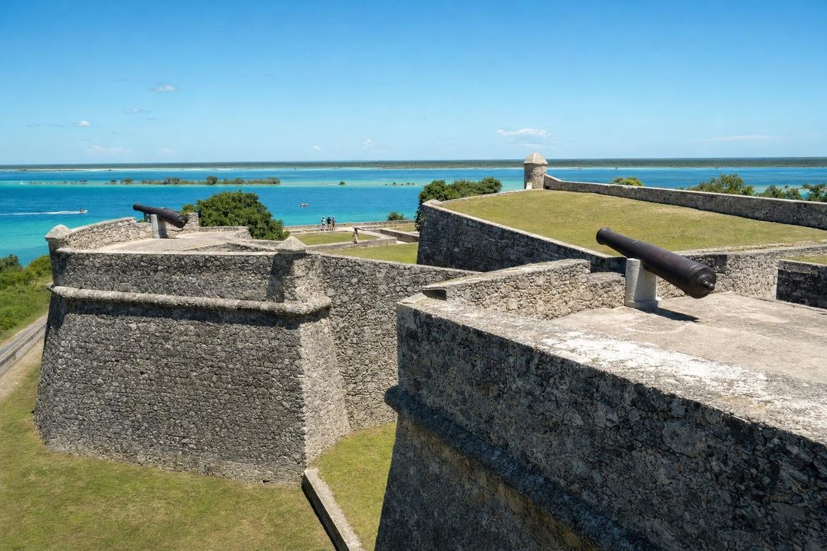
The fort that still stands above the shore, the Fuerte de San Felipe, was built in that resettlement period and finished in the early 1730s. It is a compact, star-shaped work of limestone with four bastions and a moat, designed to stop exactly the kind of raids that had emptied the town.
The next century was harder. During the Caste War of Yucatán, Maya rebels took Bacalar in 1858, and the town and its fort stayed outside government control for more than four decades, until federal troops pushed into the territory at the start of the twentieth century. Bacalar was named a Pueblo Mágico in 2006.
Things to do on Lake Bacalar
Nearly every one of the things to do here involves the water, and most can be done without a guide. The main question is how much of the lagoon you want to see: the shoreline in front of town is enough for a lazy day, while the southern channels and the far northern end need a boat or a long paddle.
Kayak or paddleboard at sunrise
Early morning is the calmest and clearest time on the lagoon. The wind usually rises toward midday and ruffles the surface, which makes paddling harder and hides the bottom. From town, a kayak or stand-up paddleboard can cover the stretch in front of the fort, cross over the shallows and reach the edge of Cenote Negro in well under an hour. Rentals are offered all along the shoreline. Life vests are worth wearing even for strong swimmers, because the water over the cenotes is very deep and the drop-off comes suddenly.
Take a boat to the pirate channel
The classic half-day trip runs south from town to the Canal de los Piratas, the narrow natural channel through which small boats once passed between the lagoon and the chain of waterways leading toward Chetumal Bay. Boats usually stop at a shallow sandbar where the white sediment is soft enough to scoop up and rub on the skin, at a ruined structure in the channel used as a swimming stop, and near the Isla de los Pájaros, a small islet where herons, egrets, cormorants and frigatebirds roost. Landing on the bird island is restricted, so the birds are watched from the water. Ask before booking whether a trip uses a motorboat or a sailboat; local rules have pushed operators toward fewer and quieter engines on the lagoon.
Swim at the public jetties
Much of the shoreline in front of town is taken up by private hotel and restaurant jetties, but there are public access points, including a balneario below the fort and a municipal swimming area at the northern end of the town front. These fill with local families on weekends. The water at the public spots is shallow and sandy, good for children and for anyone who wants to wade rather than swim.
Float through Los Rápidos
About 10 km south of town, off Highway 307, Los Rápidos is a narrow channel where the lagoon water moves fast enough to carry a floating swimmer along. It is one of the best places to see the stromatolites (described below) at close range, and one of the most popular things to do in the area, so it can be busy by late morning. Swim or float only; standing on the rocks breaks them.
Dive or snorkel Cenote Azul
Cenote Azul in Bacalar sits just off the highway at the southern end of town, separated from the lagoon by a narrow strip of land. It is a deep, round, open sinkhole ringed with trees, and swimmers can enter from the edge. Divers who want to explore its walls and ledges need a qualified local guide and cave or deep-diving training. It is a different place from the shallower Cenote Azul on the coast between Playa del Carmen and Tulum, which is described in a separate guide on this site.
Go north or south of town for quieter water
The town front is the busiest part of the lagoon. Small communities along the shore to the north and south, reached by side roads off the highway, have a scattering of cabins, a few public access points and much less boat traffic. The water there shows the same color bands without the noise of rental stands, and the evenings are darker, which suits anyone who wants to see stars over the lake. Access to the shore in these places can depend on private land, so ask before walking through a property to the water.
Visit the fort and its museum
The Fuerte de San Felipe now houses a small museum on the history of piracy in the Caribbean and on the town's long defense. The ramparts are also the best free viewpoint over Lake Bacalar, and the colored bands are easiest to see from there at midmorning, when the sun is high but before afternoon clouds build. Opening days and hours change, so check them locally.
The stromatolites of Bacalar lagoon
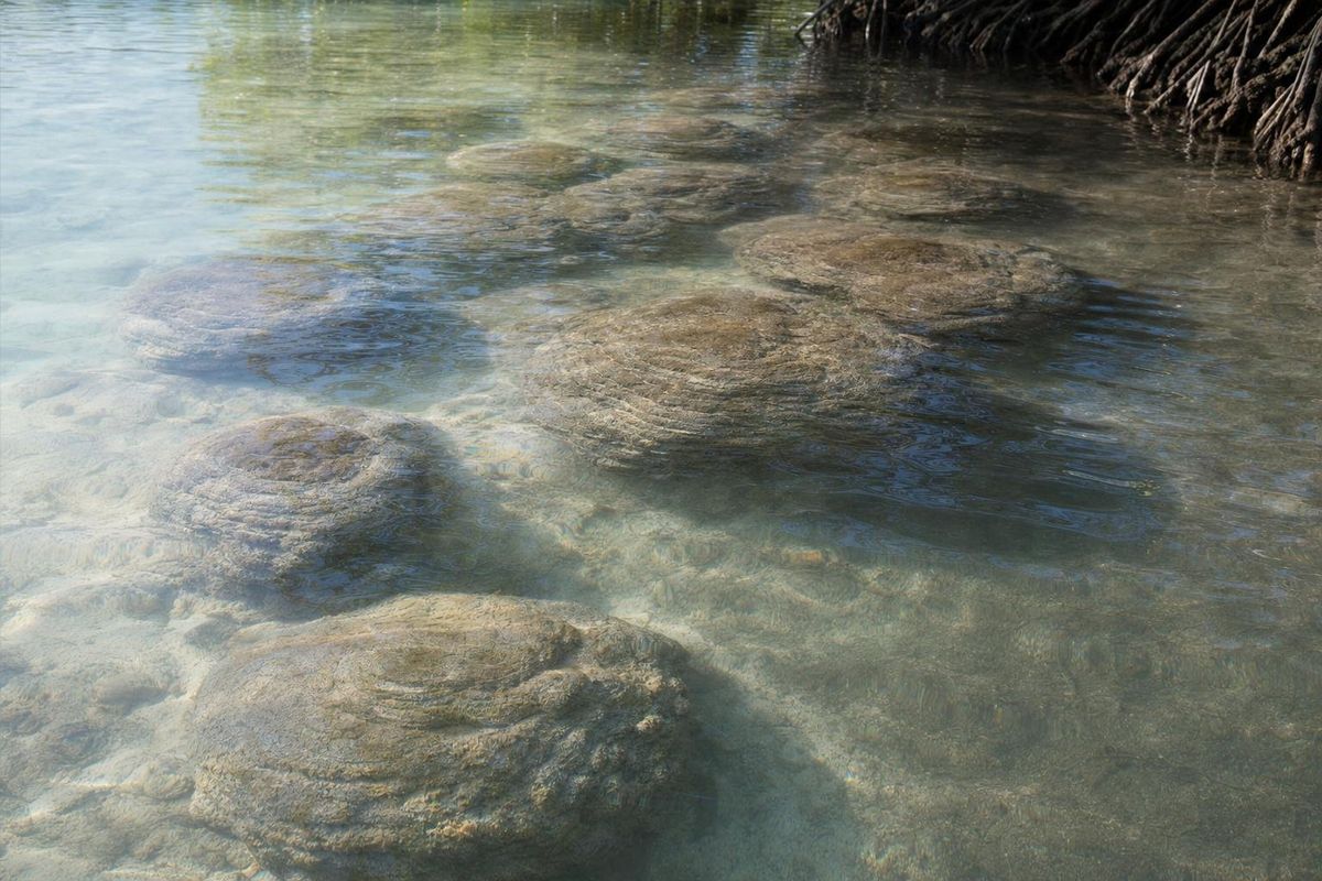
The low, rounded, cauliflower-textured rocks along parts of the shore are stromatolites. They are not coral and not ordinary stone: they are built up layer by layer by colonies of cyanobacteria, microbes that trap and bind fine sediment and help calcium carbonate to precipitate around them. Structures of this kind appear in the fossil record more than three billion years ago, which makes them among the oldest evidence of life on Earth.
Living freshwater stromatolites are rare. Bacalar has some of the largest known formations of this type, and in Mexico they are often compared with those at Cuatro Ciénegas in Coahuila. Researchers from Mexican universities have studied them for years, and the consistent message is that they grow extremely slowly and are easily damaged. Sunscreen, trampling, boat wakes and nutrient-rich runoff all harm them.
The practical rules follow from that: do not stand, sit or climb on the formations; keep fins high; and skip chemical sunscreen before entering the water. The best places to see them are Los Rápidos and stretches of the southern shore, where they rise in clusters through a meter or so of water.
Bacalar at a glance: spots around the lagoon
| Spot | What it is | How to reach it | Best for |
|---|---|---|---|
| Fuerte de San Felipe | 1730s fort with a piracy museum | On foot from the town center | History, views over the bands of color |
| Cenote Negro (Cenote de la Bruja) | Deep sinkhole inside the lagoon | Kayak or boat from town | Seeing the drop-off from shallow to dark water |
| Cenote Azul | Deep open cenote beside the lagoon | Road, southern edge of town | Swimming, guided diving |
| Canal de los Piratas | Natural channel toward Chetumal Bay | Boat tour | White-sand shallows, mangroves |
| Isla de los Pájaros | Bird roost islet | Boat, viewed from the water | Herons, cormorants, frigatebirds |
| Los Rápidos | Fast-flowing channel with stromatolites | Road, roughly 10 km south | Floating, seeing stromatolites |
Birds, mangroves and the shoreline
The lagoon is fringed with mangrove in many places, especially toward its southern channels. Mangroves are not the most photogenic part of the shore, but they hold the banks together during storms, filter water before it reaches the lagoon and shelter young fish. The same edges attract wading birds, kingfishers and ospreys. Away from the water, the scrub forest around the lagoon holds parrots, toucans, motmots and orioles, and early morning is when they are easiest to hear and see.
Fish life in the lagoon is modest compared with a reef. The water chemistry is unusual, rich in dissolved minerals, and snorkelers see small fish around the stromatolites and channels rather than schools of color. People who come to Bacalar expecting Caribbean snorkeling will be disappointed; the attraction is the water, light and structure, not the fish.
Birdwatching is one of the quieter things to do around the seven colors, and it costs nothing beyond an early start. A pair of binoculars on a jetty at dawn, looking across the shallows toward the mangrove edge, usually turns up herons stalking the sand, cormorants drying their wings on posts and, with luck, an osprey hunting over the open water.
The town around the lagoon
Away from the shore, Bacalar is a grid of low houses, unpaved side streets and small shops a few blocks deep, with the fort and the main square at its center. The square is where the town gathers in the evening: families eating ice cream and marquesitas (crisp rolled crêpes, often filled with Edam cheese), teenagers on bikes, and on some weekend nights music and dancing. The town hall, a church and a handful of cafés face it.
The population is small, and the pace matches it. Shops close for part of the afternoon in the heat, and the busiest hours are early morning, when boats and kayaks go out, and after sunset. Food is mostly regional: cochinita pibil, panuchos and salbutes, fish from the coast, and tacos at night. Simple places near the square are the cheapest, while the restaurants with jetties along the shore charge for the view.
Many visitors to Bacalar Mexico treat the town only as a place to sleep between swims, which misses its own small rhythm. A slow walk around the four sides of the fort at dusk, when the lagoon behind it turns pewter and then pink, takes twenty minutes and is one of the easier things to do on an arrival evening.
Getting to Bacalar Mexico
Bacalar lies on Federal Highway 307, the main road down the Caribbean side of the peninsula. Driving south from Tulum takes roughly three hours, and from Cancún about five; Chetumal is roughly 40 minutes further south. The road is good but passes through long stretches of forest with few services, so fill the tank in Tulum, Felipe Carrillo Puerto or Bacalar itself.
First-class buses run along the 307 between Cancún, Playa del Carmen, Tulum and Chetumal, with a stop in Bacalar, and the Tren Maya line has a Bacalar station on its southern route. Shared vans (colectivos) also link Bacalar with Chetumal and with towns to the north. Schedules and fares change often, so check them locally or with the operators directly before planning a tight connection.
The nearest airport is in Chetumal, which has domestic flights. Many travelers instead fly into Cancún or Tulum and combine the drive south with stops along the coast. Inside town, everything near the shoreline is walkable, and bicycles are a common and easy way to reach the fort, the jetties and Cenote Azul.
When to go
The dry season, roughly November to April, has the most sunshine and the calmest, clearest water, and that is when the seven colors are at their sharpest. It is also the busiest period, especially around Christmas, New Year and Easter week, when Mexican families fill the town. Weekdays in January and February are a good compromise.
From May the heat builds and the rains usually start in June. Hurricane season in the Caribbean runs from June to November, with the highest risk generally from August to October; heavy rain clouds the water and can wash sediment into the lagoon for weeks. Afternoon storms in the wet season are short, though, and mornings are often clear.
Sargassum seaweed, which can heap up on the Caribbean coast in spring and summer, does not reach the lagoon. In years when the beaches near Tulum or Mahahual are badly affected, Lake Bacalar is one of the obvious places to swim instead.
For photographs of the color bands, aim for midmorning to early afternoon on a sunny, still day. Late afternoon light is warm and pretty, but the low sun reflects off the surface and the bands lose contrast.
A simple two-day plan
On the first morning, rent a kayak at first light and paddle along the town front to the edge of Cenote Negro while the water is glassy, then return for breakfast before the wind rises. Spend the hot middle of the day at the fort museum or in the shade, and swim at Cenote Azul in the late afternoon, when the day visitors have left.
The second day suits a boat trip south to the pirate channel and the bird islet in the morning, with a float through Los Rápidos after lunch. Anyone with a third day can drive west to the Maya sites or east to the coast. Two days is enough to see the seven colors in more than one kind of light, which is the real reason to stay more than a night.
Practical notes for the lagoon
- Use mineral, reef-safe sunscreen or none at all before swimming, and rinse off if a cenote or swimming area asks you to. The stromatolites are the reason.
- Bring water shoes. The lagoon floor near some jetties is soft mud, and other stretches have sharp limestone.
- Carry cash in pesos. Card payment is common in larger businesses, but small rentals and food stands often take cash only.
- Mosquitoes come out at dusk, especially near mangroves. Repellent and long sleeves help.
- Stay off the stromatolites and away from roosting birds, and do not feed fish.
- Rental prices, tour lengths, fort hours and access fees change frequently, so confirm them on the spot.
Accommodation runs from small guesthouses in the grid of streets behind the town square to lakeside cabins with their own jetties along the road south. For most people the lake view is the point, so it is worth looking at the exact location on a map: places on the shoreline south of the center tend to be quieter, while those near the fort put the town's cafés and the square within a few minutes' walk.
Growth is the long-term issue here. Tourism to Bacalar Mexico has risen sharply since the town became a Pueblo Mágico, and most homes and many hotels along the shore still rely on septic systems rather than a sewer network. Nutrients leaking into clear, nutrient-poor water feed algae, and algae cloud the bands of color that bring people in the first place. Choosing a place to stay that treats its wastewater properly, and keeping soaps and sunscreen out of the lagoon, makes a measurable difference on a lake this sensitive.
Day trips from the lagoon
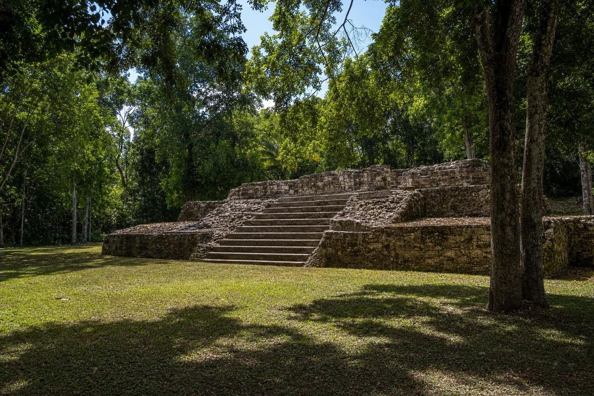
Bacalar makes a good base for the southern Maya sites. Chacchoben, with its tall temple platforms in the forest, lies roughly 45 minutes to the northeast. Toward Chetumal, the coastal site of Oxtankah combines Classic Maya plazas with a ruined early Spanish chapel, and the waterfront at Calderitas is next to it. Further west, on the road toward Escárcega, Kohunlich and its stucco masks and Dzibanché, once a seat of the Snake kings, each take a little over an hour by car.
East of the highway, the fishing village of Mahahual sits on the Caribbean coast with the reef close offshore, about an hour and a half away, and the road there passes through the village of Limones. For more lakes and rivers on the peninsula, see the lakes and rivers section.
One last detail for anyone driving north at the end of a stay: the road out of town passes the long northern stretch of the lagoon, where the water reaches almost to the highway shoulder and the bands of turquoise are visible from the car window for several kilometers.
Bacalar lagoon: frequently asked questions
Where is Bacalar?
Bacalar is in the state of Quintana Roo, in the southeast of Mexico's Yucatán peninsula. It sits on Highway 307 about 40 km north of Chetumal and roughly three hours' drive south of Tulum.
Why is it called the lagoon of seven colors?
The lagoon floor is covered in white carbonate sand, and the water's color changes with depth over it, from pale cream in the shallows to turquoise and deep indigo over the sinkholes. The number seven is a figure of speech; on a clear day there are many more shades.
Is Bacalar lagoon fresh water or salt water?
It is fresh water fed largely by groundwater rising through cenotes, though it is rich in dissolved minerals. It connects through narrow channels to waterways that lead toward Chetumal Bay.
Can you swim in the lagoon?
Yes. There are public swimming areas in town, and hotels and restaurants have their own jetties. The water is warm and calm for most of the year. Take care over the cenotes, where the bottom drops away very quickly.
Are there crocodiles in Bacalar lagoon?
Crocodiles are found in some coastal wetlands of Quintana Roo, and sightings in remote parts of the lagoon system are occasionally reported, but the swimming areas in front of town are used every day by locals and visitors. Follow local advice and avoid swimming in dense mangrove at dusk.
What are the stromatolites?
They are rock-like structures built up very slowly by colonies of cyanobacteria. Similar structures are among the oldest evidence of life on Earth, and the Bacalar formations are among the largest freshwater examples known. Do not stand or sit on them.
What are the best things to do in Bacalar?
Kayaking or paddleboarding at sunrise, a boat trip to the pirate channel, floating at Los Rápidos, swimming at Cenote Azul and visiting the Fort of San Felipe are the main ones. The southern Maya sites make good day trips.
How many days do you need?
Two full days cover the lagoon itself, with one morning on the water and one for Los Rápidos and the fort. A third or fourth day allows a trip to Kohunlich, Dzibanché or the coast at Mahahual.
When is the best time of year to visit?
November to April usually brings the sunniest weather and the clearest water. The rainy season and hurricane season, from about June to November, can cloud the lagoon after heavy storms.
Does sargassum reach Bacalar?
No. Sargassum seaweed washes up on the Caribbean beaches, but the lagoon is inland and fresh, so it is not affected.
How do you get to Bacalar without a car?
First-class buses along Highway 307 stop in Bacalar, the Tren Maya has a station there, and shared vans run to Chetumal. Schedules change, so check them locally before traveling.
Is Cenote Azul in Bacalar the same as Cenote Azul near Playa del Carmen?
No. Bacalar's Cenote Azul is a very deep sinkhole beside the lagoon in the far south of the state. The other is a shallower cenote on the coast road between Playa del Carmen and Tulum, some 250 km to the north.
Can you visit the Fort of San Felipe?
Yes. The fort houses a small museum on the town's history and on piracy in the Caribbean. Opening days and hours change, so confirm them on arrival.
What sunscreen should you use in the lagoon?
Mineral sunscreen applied well before swimming, or a long-sleeved rash guard instead. Chemical sunscreens harm the stromatolites and other life in the lagoon.
Nearby on the map
AI-generated image Maya Ruins · Quintana Roo
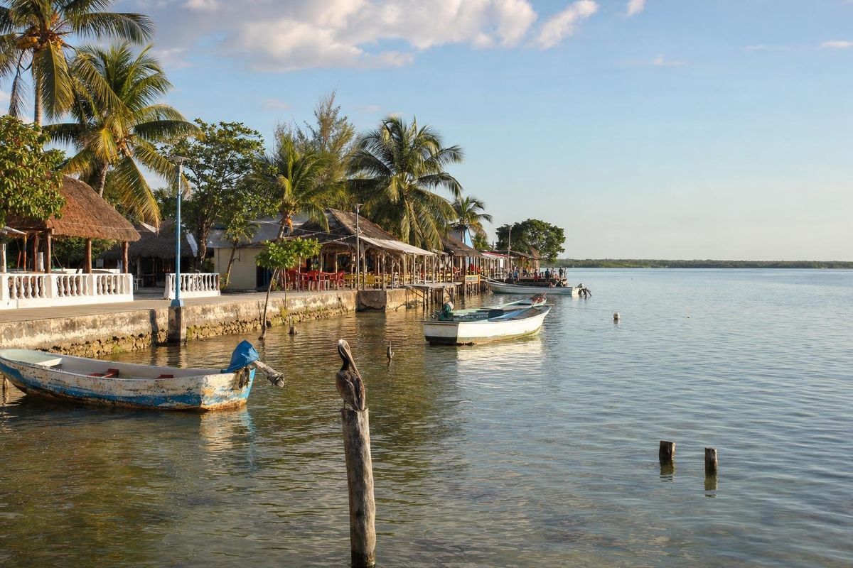
Oxtankah
AI-generated image Towns & Villages · Quintana Roo
Calderitas
AI-generated image Maya Ruins · Quintana Roo
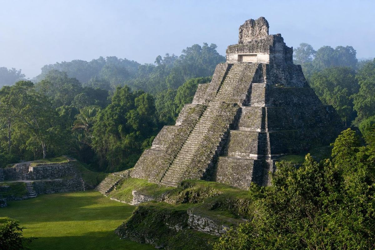
Dzibanché
AI-generated image Maya Ruins · Quintana Roo
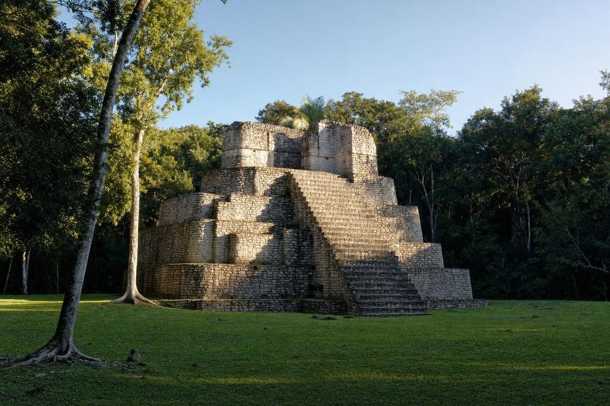
Chacchoben