
−5 m · Shallows · Beaches · Yucatán
El Cuyo, Yucatán: a Fishing Village Beach Between Lagoon and Gulf
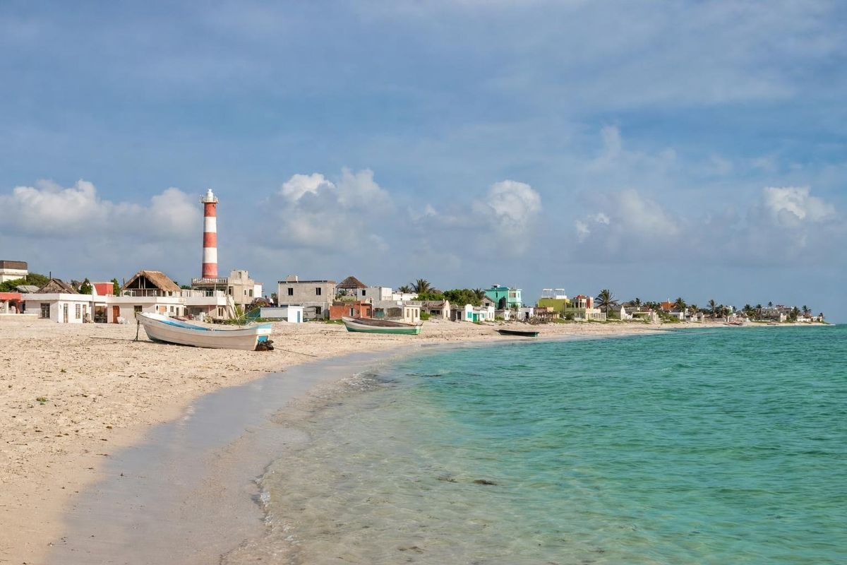
El Cuyo is a small fishing village at the far eastern end of Yucatán's Gulf coast, on a sandbar between the sea and a long lagoon inside the Ría Lagartos Biosphere Reserve. El Cuyo, Yucatán, has kept its weekend-by-the-sea character: a wide beach, steady afternoon wind for kitesurfing, flamingos and herons in the lagoon behind town, and very little in the way of resorts. The usual approach is from Tizimín, through cattle country and across a causeway.
El Cuyo, Yucatán: a sandbar village at the end of the road
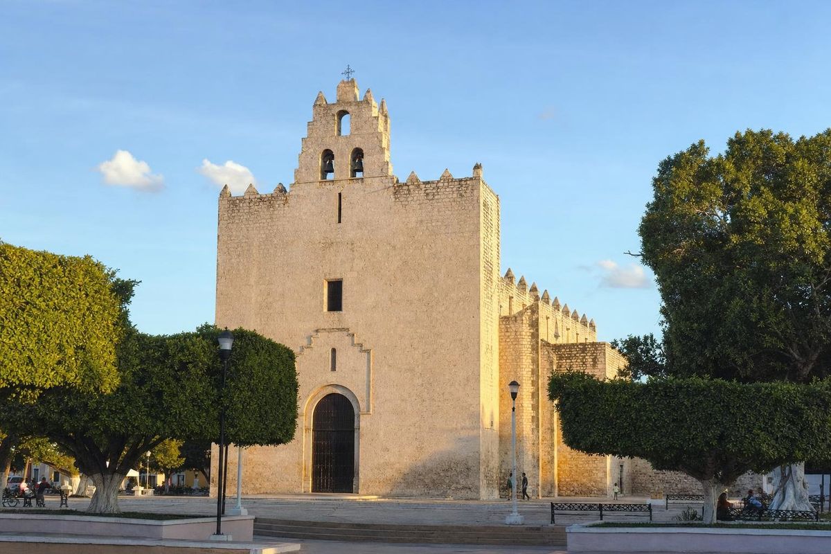
The last stretch of road into El Cuyo runs over flat savanna and then across the lagoon on a causeway. On a sunny day in the dry season the water on either side can take on a pinkish tint from the salt and the organisms that live in it. On the far side is the village: a grid of sandy streets, a square with a church, a pier, a lighthouse, and houses painted in strong colors or not painted at all.
For a long time El Cuyo was a beach for people from the interior of the peninsula, families from Tizimín, Valladolid and the ranches who came for a few days in the holidays. That has not changed much. Foreign visitors are fewer than on the Caribbean coast, and much of the accommodation is simple cabins and rented houses. The pace is set by the fishing boats and the wind.
The coast here has a deep history. Low mounds along the shore mark old Maya settlements, part of the chain of coastal sites that linked the interior with sea trade; the island port of Isla Cerritos lies to the west near San Felipe. In the twentieth century the inland area around Colonia Yucatán was logged for timber, and the sapodilla trees of the region were tapped for chicle, the natural latex that was the original base of chewing gum.
The beach at El Cuyo
The beach is long, wide and gently shelving, with pale sand and shallow water that can be turquoise on a calm morning and greener when the wind has stirred it up. Palms and a row of beach houses line the back of the sand on either side of the village. Walk ten minutes east or west and there is usually nobody else in sight.
Like most of the peninsula's coast, El Cuyo can get seaweed and storm debris after rough weather, and on some days the water turns brown and the sand smells. It comes and goes, sometimes overnight. If the beach is the whole point of the trip, ask locally about conditions before driving out.
The water stays shallow for a long way, which makes it good for small children and for wading, less so for real swimming.
Kitesurfing and the wind
El Cuyo has built a reputation for kitesurfing because of a dependable onshore and cross-shore breeze, typically strongest from late morning into the afternoon, and a wide, flat, shallow area inside the surf line. Beginners like the standing-depth water; experienced riders use the lagoon side on some days for flat water. Lessons and equipment rental are offered in the village, but operators change from season to season, so check what is running when you arrive. The windiest months are generally in the spring and again in winter, when the cold fronts come through.
The lagoon, flamingos and birds
El Cuyo sits inside the Ría Lagartos Biosphere Reserve, one of the most important wetlands in Mexico and one of the country's earliest sites listed under the Ramsar convention on wetlands. The reserve holds the main nesting colonies of the American flamingo on the peninsula, and flamingos often feed in the lagoon behind El Cuyo, especially in the cooler months. Herons, egrets, spoonbills, pelicans and frigatebirds are common; in winter the lagoon fills with migratory shorebirds.
Boat and kayak trips into the mangroves are offered locally. Nesting areas are protected and off-limits, and boats should keep their distance from flamingo flocks. The reserve is managed by CONANP. For a wider look at flamingo wetlands on the other side of the state, see Celestún.
Sea turtles also nest on the less disturbed beaches of the reserve in the warm months; keep lights low near the dunes at night and give any marked nests a wide berth.
How to reach El Cuyo, Mexico
Most routes run through Tizimín, the main town of the municipality. From Tizimín, take the road north-east towards Colonia Yucatán, then follow the signs north to El Cuyo; the drive is usually about an hour and a half. From Valladolid, add roughly another 45 minutes to reach Tizimín first. From Cancún, drivers usually take the toll highway towards Mérida, leave at the exit for Kantunilkín and Holbox, and continue through Kantunilkín and Colonia Yucatán. Expect around three hours or more, depending on stops.
Buses and colectivo vans connect Tizimín with El Cuyo, but schedules are not published reliably, and services can be sparse. A car gives much more freedom on this coast. Check routes and departures locally.
El Cuyo Mexico maps sometimes suggest a quick coastal hop to the pink ponds of Las Coloradas, to the west. There is no coast road between the two across the lagoon system, so the drive loops back inland and takes far longer than the distance suggests. A closer pink lake for those based in Mérida is the Laguna Rosada at Xtampú.
When to go
The dry season, from about November to April, has the most reliable weather, with winter cold fronts bringing occasional windy, cooler and cloudy days. Easter week and the July and August school holidays fill the village with Mexican families. The hurricane season runs roughly from June to November, with the highest risk late in the season. Wind for kiting is fairly consistent much of the year.
Practical notes
- Bring cash. Card payments are not reliable and there may be no working cash machine in the village.
- Shops are small and basic, so stock up in Tizimín if you need anything specific.
- Mosquitoes can be heavy near the lagoon at dusk, especially after rain.
- Rinse off sunscreen or use a reef-safe one before swimming in the lagoon or the sea.
- The ruins of Kulubá, south of the coast in Tizimín municipality, make a stop on the drive in or out.
More of the region's shorelines are collected under Beaches.
El Cuyo questions
Where is El Cuyo?
El Cuyo is at the eastern end of the Gulf coast of Yucatán state, close to the border with Quintana Roo. It belongs to the municipality of Tizimín and lies inside the Ría Lagartos Biosphere Reserve.
Is El Cuyo good for swimming?
The water is shallow and usually calm in the morning, good for wading and children. Afternoon wind and occasional seaweed can make conditions less pleasant.
Can you see flamingos at El Cuyo?
Often, yes. Flamingos and many other wading birds feed in the lagoon behind the village, especially in the cooler months. Keep a respectful distance from any flock.
How long does it take to get to El Cuyo from Cancún?
Usually around three hours by car or more, via the toll highway towards Mérida, Kantunilkín and Colonia Yucatán. Road conditions and stops can make it longer.
Is El Cuyo good for kitesurfing?
Yes. Reliable afternoon wind and wide shallow water make it popular with beginners and experienced riders. Lessons and rentals are available locally in season.
Nearby on the map
AI-generated image Beaches · Yucatán
Cancunito
AI-generated image Islands · Yucatán
Isla Cerritos
AI-generated image Maya Ruins · Yucatán
Kulubá
AI-generated image Towns & Villages · Yucatán
Tizimín