
−5 m · Shallows · Cenotes · Quintana Roo
Cenote Tankach-Ha near Cobá: Jumping into a Deep Cave Cenote
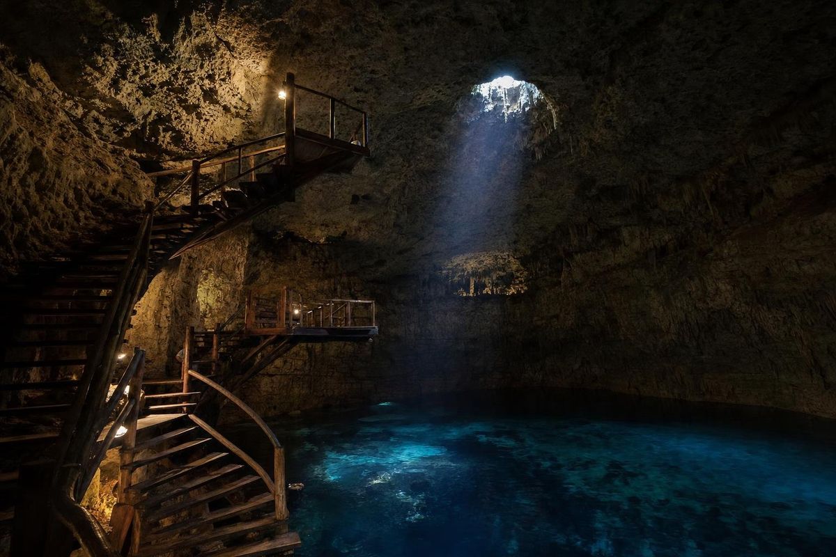
Cenote Tankach-Ha is a fully enclosed cave cenote a few kilometers from the ruins of Cobá, reached through a small hole in the ground and a steep stairway. The water is deep, dark and cool, and two wooden platforms built at different heights inside the cave make it the place for jumping among the three community-run cenotes on this road. The name appears in several spellings, including Tamkach-Ha and Tamcach-Ha.
A cave built for jumping
Everything about Tankach-Ha points downward. The entrance is a narrow opening in the forest floor, and the stairs drop steeply into a chamber that is almost completely closed. Electric lights have been installed to supplement the little daylight that reaches inside, which gives the cave a warm, slightly theatrical glow. A small bench near the bottom of the stairs is the only dry space for bags, and it fills quickly, so it pays to carry very little down.
The name is generally rendered as "deep water", and the pool lives up to it. Figures of up to around 35 m are often quoted for the deepest part, with shallower ledges near the edges; the exact depth is hard to verify, but the color says enough. Where other cenotes glow turquoise, Tankach-Ha looks inky blue or almost black, simply because there is so much water below.
That depth is what allows the jumping. A wooden spiral staircase leads up to two platforms, a lower one a few meters above the water and a higher one well above that. Jumpers land in the deep center, and the echo of each splash fills the cave. Watching is free and entertaining; the higher platform is not for everyone.
Swimming in deep, dark water
For swimmers, Cenote Tankach-Ha is a stronger experience than its shallow neighbor. There is no standing room in the middle, the water is cool at roughly 24 to 25°C, and the dim light makes the space feel enclosed. Ropes give something to hold on to, and life jackets are sensible for anyone who is not a confident deep-water swimmer.
Look up between swims. The ceiling carries small stalactites, and roots from the forest above sometimes find their way through cracks in the rock. Small fish live in the pool; they are harmless.
- Jump feet first, one person at a time, and check the landing zone is clear.
- Do not jump if the water level or lighting makes the landing hard to judge.
- Children should wear life jackets throughout.
Tankach-Ha and its two neighbors
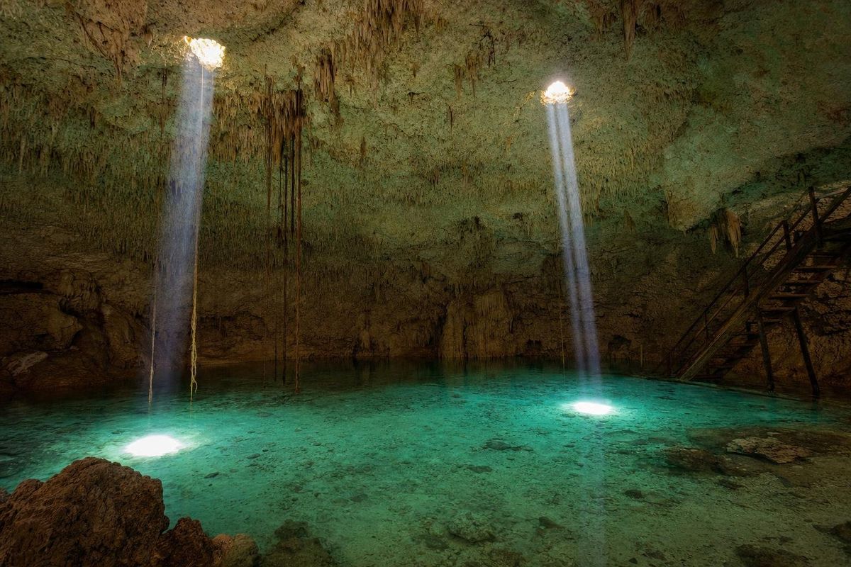
The cenote is one of three on the same road south of Cobá, all managed by the local community. Cenote Choo-Ha is shallow and bright under a ceiling of stalactites, ideal for snorkeling and for children. Multún-Ha, the third, is another deep cavern with a long stairway and very clear water, good for floating and for freediving practice. Tankach-Ha is the one for jumping. Seeing all three is easy in an afternoon, and the contrast between them is part of the point.
A small booth on the road before the first cenote has sold tickets for each site separately. Prices change, so confirm them on arrival.
How cenotes like this formed
The Yucatán peninsula is built from layers of limestone laid down in shallow seas, then lifted above sea level. Rainwater, slightly acidic, dissolves the rock as it seeps through, carving caves and underground rivers. When sea levels were lower during the ice ages, many caves were dry, which is when stalactites grew; as the seas rose, the caves flooded. Where a roof thins and collapses, a cenote opens. Tankach-Ha is still at an early stage of that process, a mostly intact cave with only a small opening.
Geologists also connect the pattern of cenotes in northwestern Yucatán to the Chicxulub impact crater, buried beneath the peninsula and linked to the extinction of the dinosaurs about 66 million years ago. A semicircular "ring of cenotes" traces the crater's buried rim around Mérida. The Cobá cenotes lie well away from that ring and belong to the wider karst of the peninsula.
For the Maya, such caves were sources of water and sacred places linked to the rain god Chaak and to Xibalbá, the underworld. Cobá, with its lakes and its network of stone causeways, was one of the major cities of the northern lowlands, and its unexcavated mounds are visible from the road to the cenotes.
Getting there and timing
Cobá lies roughly 45 km northwest of Tulum. From the ruins' car park, follow the road along the lake through the village and take the signed turn toward the cenotes and Chan Chen. The ticket booth comes first; Tankach-Ha sits a short distance beyond Choo-Ha on a smaller road. A rental car is the easiest way in; bicycles can usually be rented in Cobá village, and taxis are irregular. There is no public transport to the cenotes themselves.
Visit the ruins first, early, and the cenotes after. Because the cave is enclosed, the time of day matters less here than at open cenotes, though the small daylight shaft is brightest around noon. The weather barely reaches underground: the dry season from about November to April and the rainy, hurricane-prone months that follow make little difference to the water.
- Bring water and food; services are minimal.
- Carry cash in pesos.
- Wear water shoes on the wet stairs and platforms.
- No sunscreen or repellent in the water.
After the swim, Cobá village has small restaurants along the lake, and craft shops selling hammocks, embroidery and wood carvings. For other cave pools in the region, see the cenotes of Yucatán route, the lamp-lit cavern at Zazil Tunich near Valladolid, and the full cenotes list.
Cenote Tankach-Ha: quick answers
How high are the jumping platforms?
There are two: a lower one a few meters above the water and a higher one well above that. The higher jump is only for confident swimmers.
Is Tankach-Ha the same as Tamkach-Ha?
Yes. The name is spelled several ways, including Tankach-Ha, Tamkach-Ha and Tamcach-Ha.
Is the cenote suitable for children?
Only with life jackets and close supervision. The water is deep and the stairs are steep; nearby Choo-Ha is the easier choice for families.
Do you need your own transport?
Practically, yes. There is no bus to the cenotes. A car or a rented bicycle from Cobá village works best.
How long should the visit take?
Around an hour is enough for a swim and a few jumps. Allow two to three hours to see all three Cobá cenotes.
Nearby on the map
AI-generated image Cenotes · Quintana Roo
Choo Ha
AI-generated image Towns & Villages · Quintana Roo
Maya villages
AI-generated image Jungles · Quintana Roo
Punta Laguna
AI-generated image Cenotes · Quintana Roo
Escondido