
−20 m · Stone · Maya Ruins · Yucatán
Oxkintok Ruins: the Satunsat Labyrinth and an Early Puuc Maya City
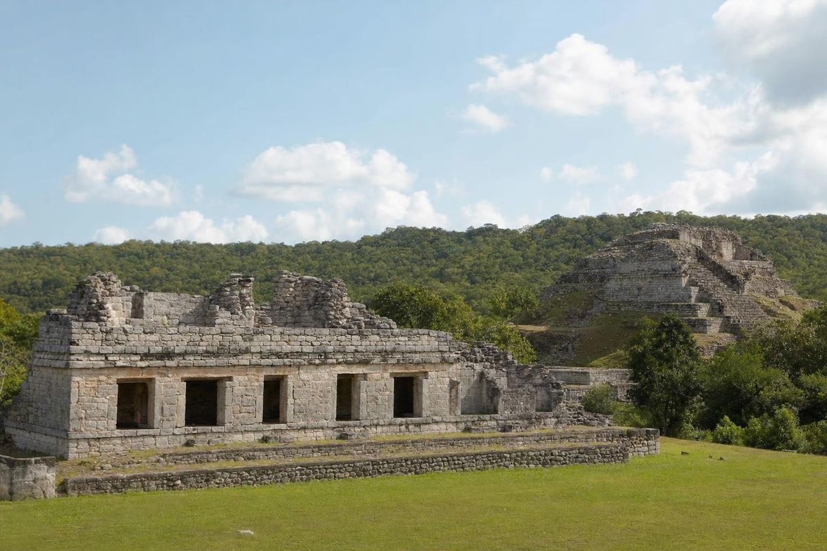
Oxkintok is a large Maya city at the northwestern edge of the Puuc hills, close to the town of Maxcanú and roughly an hour's drive southwest of Mérida. It is older than Uxmal and most of the Puuc sites, it holds one of the earliest dated inscriptions in northern Yucatán, and its best-known building, the Satunsat, is a dark three-level labyrinth. Visitor numbers are low, so the plazas are usually quiet.
One of the first cities of the Puuc
The name is usually broken down as ox (three), k'in (sun or day) and tok' (flint), often rendered as "three sun flint" or "three day flint," which may be a calendar name. Pottery shows people at the spot in the Late Preclassic. The city grew in the Early Classic and stayed important through the Late Classic, from about AD 300 to 900, before declining as Uxmal rose to the south.
Oxkintok matters to archaeologists because it shows how Puuc architecture began. Its early buildings use thick walls and rougher masonry, and later ones show the veneer stone and mosaic facades that became the hallmark of the Puuc style. In between, archaeologists describe phases known as Proto-Puuc and Early Puuc. Visiting Oxkintok before Sayil or Labná makes those later cities easier to read.
The city also has carved lintels and stelae with hieroglyphic texts. One lintel carries a Long Count date that falls in the late fifth century AD, among the earliest firmly dated inscriptions known in the north. Most of the excavation and restoration was carried out from the late 1980s by a Spanish archaeological mission working with INAH.
How Puuc buildings were made
The difference between early and late construction at Oxkintok is easy to see once the method is clear. Early builders stacked roughly shaped blocks into thick load-bearing walls and closed rooms with corbel vaults of flat slabs. Later Puuc architects reversed the logic: the core of a wall or vault was a mass of rubble set in lime mortar, close to a concrete, and the visible stones were thin, finely cut facing slabs that carried no weight at all. That change freed the upper facades for decoration, the stone mosaics of frets, lattices and masks that cover the palaces of Uxmal and Labná.
At Oxkintok, walls of both kinds stand within a short walk of each other. In some of the May Group rooms, the older, heavier vaults are still visible, while the facing on later buildings is cut with sharp edges. Fallen facing stones lying at the foot of collapsed walls show how thin that skin really was.
The Satunsat labyrinth
The Satunsat, sometimes also called Tzat Tun Tzat, is the building most visitors come for. From the outside it is a modest structure; inside, narrow passages and small chambers connect across three levels, with very little light and few windows. Its local name is often translated as "place where one gets lost."
What it was for is not settled. Some researchers think it was used for initiation rites or ceremonies linked to the underworld, with the darkness standing in for a cave. Others point to small openings that may have been aligned with the sun on particular days and suggest an astronomical function. Both readings may hold some truth. Access to the interior depends on the custodian and on conservation rules at the time; a flashlight is useful if it is open.
Groups and buildings to walk through
Oxkintok is spread over several architectural groups on low hills, linked by paths. The main ones visitors reach are:
- The May Group, with a large restored palace platform and rooms that show the early, heavier style of construction.
- The Ah Dzib Group, named after a palace whose lintels carry glyphs; the name means something like "the writer."
- The Ah Canul Group, where carved stone figures in elaborate dress, usually read as rulers or dignitaries, have been found.
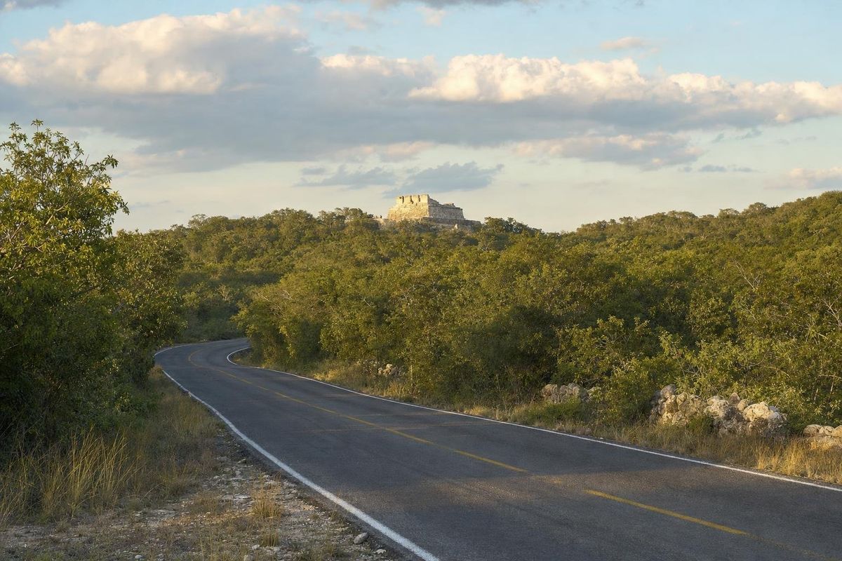
- The main pyramid, a tall, partly restored mound from which the flat Yucatán plain stretches north and the Puuc ridge rises south.
Stucco decoration survives in places, but much of the original painted surface has gone. The rough slopes between the groups are also where the site's charm lies: unexcavated mounds covered in dry forest, birds such as motmots in the trees, and long views with no road in sight.
A full loop on foot takes around two hours at an easy pace.
The Calcehtok caves next door
A short drive from the ruins are the Grutas de Calcehtok, a large dry cave system also known as X'pukil. The caves were used by the Maya for water, refuge and ritual, and pottery and other remains have been found inside. Local guides from the village lead visits; some routes are easy walks under collapsed ceilings, others involve crawling and climbing in the dark. Conditions and what the guides offer vary, so ask in advance and wear old clothes for the longer routes. For a larger, lit cave with paths, Loltún in the southern Puuc is the easier option.
How to get to Oxkintok
From Mérida, the route follows the highway southwest toward Campeche as far as Maxcanú, then a smaller road south for a few kilometers to the site. By car the drive takes about an hour. Public transport reaches Maxcanú, but the last stretch needs a taxi, which makes a rental car the practical choice.
Oxkintok fits well at the start of a Puuc itinerary, before continuing southeast toward Muna and Uxmal. The Puuc hills road trip outlines a route that links it with the other sites.
Before you go
The site is managed by INAH; opening times and fees change and are best checked locally or on the INAH website. Facilities are basic. Bring water, a hat and insect repellent, since the walks between groups are long and shade is patchy. Good shoes help on the uneven paths.
Because few tour buses come here, it is one of the better Maya sites in Yucatán for watching birds early in the day. The other cities of the region are listed in the Maya ruins section.
Oxkintok: common questions
Where is Oxkintok?
In western Yucatán, a few kilometers south of the town of Maxcanú and about an hour by car southwest of Mérida.
What is the Satunsat?
A building with dark, narrow passages and small chambers on three levels, often called the labyrinth. Its purpose is debated; ritual and astronomical uses have both been proposed.
How old is Oxkintok?
Occupation began in the Late Preclassic. The city flourished from roughly AD 300 to 900, and one of its lintels carries a date from the late fifth century AD.
Can Oxkintok and the Calcehtok caves be seen in one day?
Yes. The caves are a short drive from the ruins, and both fit into a day trip from Mérida with an early start.
Is Oxkintok busy?
Usually not. It sees far fewer visitors than Uxmal or Chichén Itzá, and on many mornings the plazas are close to empty.
Nearby on the map
AI-generated image Maya Mysteries · Yucatán
Phallic Cult
AI-generated image Maya Ruins · Yucatán
Uxmal
AI-generated image Haciendas · Yucatán
Hacienda Ochil
AI-generated image Trips · Yucatán
Puuc Hills