
−5 m · Shallows · Cenotes · Yucatán
Cenote Xcajum near Chichen Itza: Swimming Guide and How to Get There
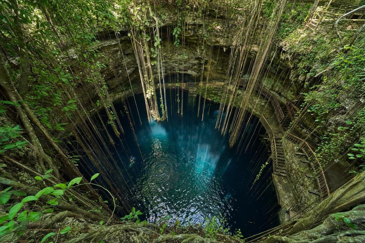
The Xcajum cenote is a deep, open sinkhole in the countryside north of Pisté, roughly 15 km by road from the gates of Chichén Itzá. It has the same drama as the famous Ik Kil (a round shaft open to the sky, water far below) but far fewer visitors, which makes Cenote Xcajum the better swim for anyone who has just spent the morning in the heat of the ruins.
Why Cenote Xcajum is worth the detour
Most people who want a swim near Chichen Itza end up at Ik Kil. It sits about 3 km from the archaeological zone, it is beautiful, and it fills with tour groups from late morning. Cenote Xcajum (pronounced roughly "shka-hoom") is a short drive further away and works on a different rhythm: it is a privately run park on rural land near the small town of Dzitás, and outside the hours when a coach happens to pull in, the pool can be close to empty.
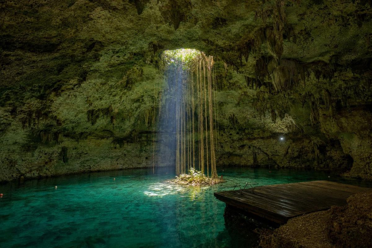
The cenote itself is a classic Yucatán sinkhole. The roof of a cavern collapsed long ago, leaving a vertical shaft whose walls drop well below ground level before reaching the water. Light comes straight down from above, roots hang from the rim, and the water at the bottom looks anything from deep blue to almost black depending on the time of day. Standing at the top, it feels more like a cave than a pool, even though the sky is right there.
Above ground the grounds are kept tidy, with garden paths, shade and hammocks strung between trees. Changing rooms and showers have generally been in good shape, which is not a given at rural cenotes. A restaurant and a snorkel rental counter have operated on site, though what is open on a given day changes and is worth checking locally.
Swimming in the cenote
Getting down is half the experience. A wide staircase leads through a cut in the rock and then along the inside of the shaft, so the light changes step by step as you descend. At the bottom, wooden steps or a platform lead into the water. The water is deep right away, and a rope stretched across the pool gives swimmers something to hold on to while they look up at the circle of sky.
Swimming at Cenote Xcajum is cold by Caribbean standards. Cenote water in the region tends to sit at around 24 to 25°C all year, which feels sharp on a hot afternoon and wonderful a minute later. Visibility is good because the water has filtered through limestone, and snorkel gear shows the rock walls dropping away into the dark. Life jackets have usually been available, and they are a sensible idea for children and for anyone who is not a confident swimmer in deep water.
- Expect steep, sometimes wet wooden steps at the water's edge; go slowly.
- Swimming is in deep water throughout: there is no shallow end.
- Rinse off sunscreen, repellent and lotions in the showers before entering.
Cenote Xcajum or Ik Kil: choosing a swim near Chichen Itza
Both are open, deep and spectacular, and both are close enough to combine with the ruins. Ik Kil is the easier choice without a car, because it lies on the main road and many tours include it. It is also the busier one, with diving platforms and a queue at peak hours. The Xcajum cenote asks for a slightly longer drive on smaller roads and rewards it with space and quiet. For a first visit to the region with a rental car, Xcajum is the stronger pick; for a tour without your own transport, Ik Kil is often the only practical option.
A rough rule that holds up well: mornings at Ik Kil are calmer than afternoons, and afternoons at Xcajum are calmer than almost anywhere near Chichen Itza.
How to get there from Chichén Itzá and Pisté
Pisté is the town that has grown up beside Chichén Itzá on the old Mérida to Valladolid highway (federal road 180, not the toll motorway). From Pisté, a local road runs north toward Dzitás, and Cenote Xcajum lies off that road, roughly 15 km from the archaeological zone. The last stretch is a short access track. Signage has been modest in the past, so it helps to work out how to get there before leaving Pisté, where mobile signal is reliable, and to save the route offline.
There is no regular public transport that stops at the cenote. The practical options for how to get there are a rental car, a taxi arranged in Pisté (agree on a pick-up time, because cars do not wait outside rural parks), or a tour that lists it by name. Some day tours from Cancún and the Riviera Maya now include it as their swimming stop instead of Ik Kil.
For visitors based in Valladolid, how to get there is just as simple: the drive is about 45 minutes to an hour, which makes Xcajum a sensible afternoon stop on a loop that starts at the ruins and ends back in town. From Mérida, allow closer to two hours each way.
When to go
The best timing is simply after the ruins. Chichén Itzá is at its best early, before the heat and the crowds, so a late-morning or early-afternoon swim at Xcajum fits naturally. Like most cenotes, the shaft looks most dramatic around midday, when sunlight reaches the water; later in the afternoon the pool sits in shade and the water darkens.
The dry season, roughly November to April, brings clearer skies and more visitors to the whole area. The rainy months from about June to October are hot and humid, with short afternoon storms, and the Atlantic hurricane season runs through the same period. Cenote water itself is barely affected by the seasons, which is part of the appeal: when the coast has sargassum, the cenotes inland are unaffected.
Cenotes and the ancient Maya
The Yucatán peninsula is a plate of porous limestone with almost no surface rivers. Rain seeps straight down and flows through underground channels, and where a cave roof gives way a cenote opens. The word comes from Yucatec Maya ts'onot, roughly "well" or "sinkhole", which Spanish speakers turned into cenote.
For the Maya these openings were water supply and sacred space at once. Chichén Itzá itself grew up around two large cenotes, and its Sacred Cenote was a place of offerings: when Edward H. Thompson dredged it in the early twentieth century he recovered jade, gold, pottery, copal incense and human remains. Many scholars link such offerings to Chaak, the rain god, and to the belief that cenotes opened onto the underworld. The Chichén Itzá guide covers the site in detail, and UNESCO's listing for Pre-Hispanic City of Chichen-Itza sets out why it became a World Heritage Site in 1988.
Practical notes for the visit
Bring a towel, water shoes for the wet steps, cash in pesos, and a dry bag or small pouch for a phone. Entrance fees, food service and opening hours change, so check them locally or with the operator before setting out, and note that most rural cenotes close in the late afternoon.
Biodegradable sunscreen is still sunscreen: the rule at almost every cenote is no creams of any kind in the water, and staff often ask visitors to shower first. Photography is generally allowed; drones usually need permission.
For a wider plan, the Xcajum cenote pairs well with the ruins and an evening in Valladolid; the Valladolid trip notes and the cenotes of Yucatán route list other stops nearby, including Hubiku to the east. More swimming holes are gathered on the cenotes page.
Cenote Xcajum: common questions
How far is Cenote Xcajum from Chichén Itzá?
About 15 km by road, north of Pisté toward Dzitás. With a car it is a drive of roughly 20 minutes from the archaeological zone.
Is the Xcajum cenote better than Ik Kil?
It is quieter. Ik Kil is closer to the ruins and easier to reach without a car, but it is much busier. For a calm swim near Chichen Itza with your own transport, Xcajum is usually the better choice.
Can children swim at Cenote Xcajum?
Yes, with care. The water is deep from the first step and the stairs can be slippery, so life jackets are a good idea for children and weak swimmers.
Is there a bus to the Xcajum cenote?
Not directly. Buses reach Pisté, but the cenote lies off a local road with no regular service. A taxi from Pisté, a rental car or a tour are the realistic options.
Is sunscreen allowed in the cenote?
No. As at nearly all cenotes, visitors are asked to shower and enter without sunscreen, repellent or lotion to protect the water.
Nearby on the map
AI-generated image Maya Mysteries · Yucatán
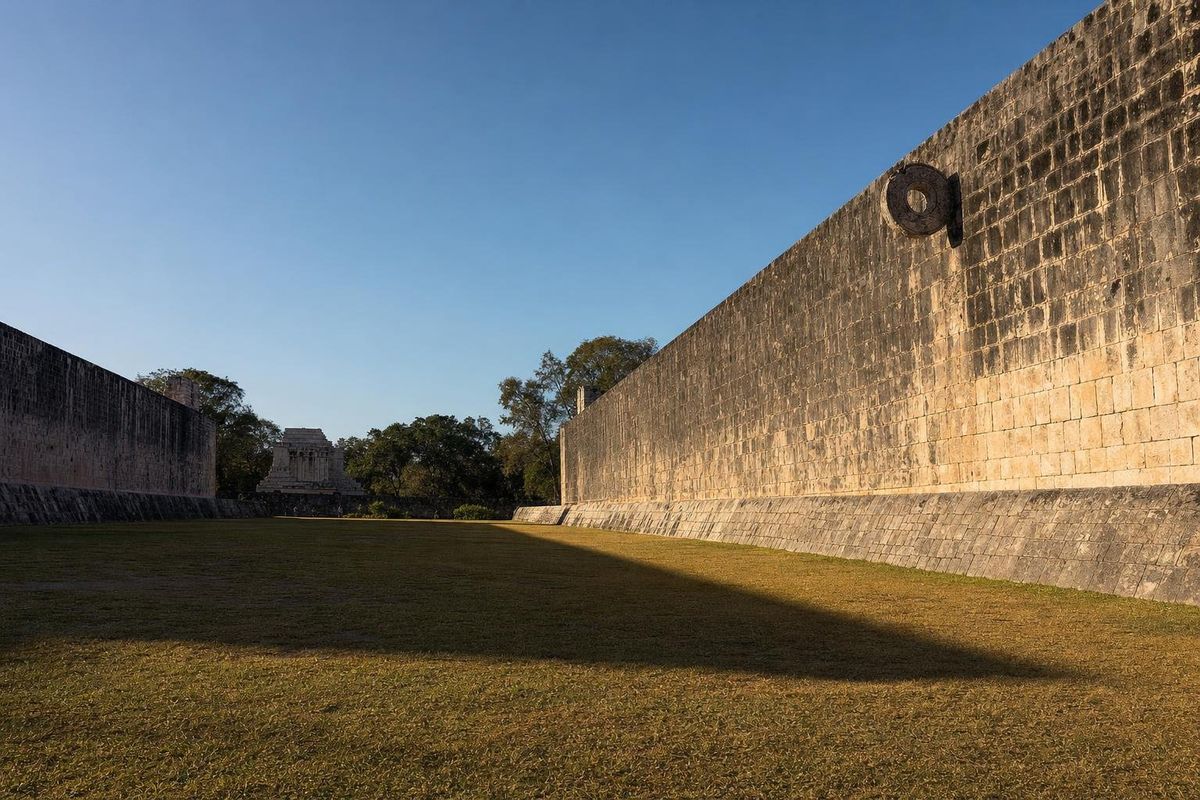
Ballplayers
AI-generated image Maya Mysteries · Yucatán
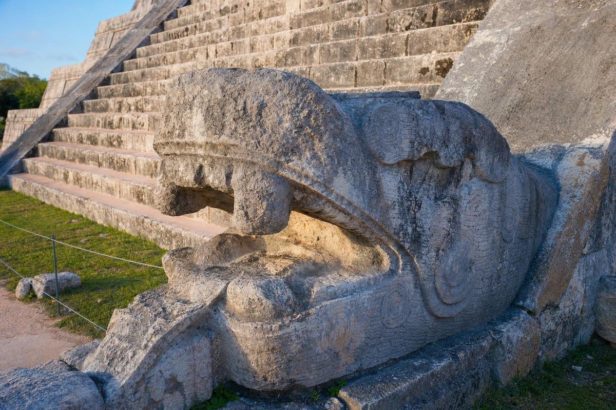
Feathered Serpent
AI-generated image Maya Ruins · Yucatán
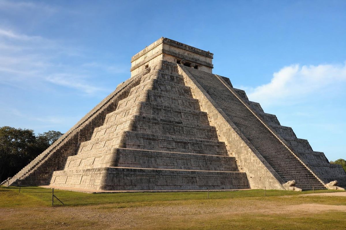
Chichén Itzá
AI-generated image Cenotes · Yucatán
Hubiku