
−20 m · Stone · Maya Ruins · Campeche
Calakmul: The Rainforest Capital of the Maya Snake Kings in Campeche
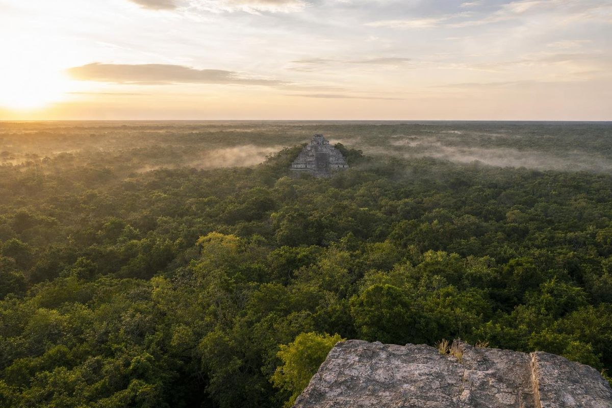
Calakmul is a Maya city deep in the forest of southern Campeche, about 35 km from the Guatemalan border, and in the seventh century it was the seat of the most powerful dynasty in the Maya lowlands: the Kaanul, or Snake Kings. Today it is reached by a long, narrow road through the Calakmul Biosphere Reserve, and visitors can climb two of the largest pyramids the Maya built and look out over forest in every direction.
What Calakmul was
Calakmul was settled in the Preclassic period, centuries before Christ, and grew into one of the largest cities of the Maya world. The core covers a broad area of plazas, palaces and pyramids, and the wider city spread for many square kilometers over a low rise above a seasonal swamp, the bajo El Laberinto, which supplied water and farmland.
The ruins were recorded for science only in 1931, when the biologist Cyrus Lundell came across them while surveying the forest for chicle, the tree resin used to make chewing gum. He gave the place its modern name, which he explained as "two adjacent mounds". Systematic work began in the 1980s with a team led by William Folan, and from the 1990s a long INAH project directed by Ramón Carrasco opened up much of what visitors see today.
The site and the forest around it are protected together. The Calakmul Biosphere Reserve was created in 1989, and UNESCO lists the Ancient Maya City and Protected Tropical Forests of Calakmul as a World Heritage site for both its cultural and natural value.
The Snake Kings of Calakmul
The emblem glyph of the Snake Kings shows a snake's head, read as Kaan or Kaanul. Through the sixth and seventh centuries this dynasty built a network of alliances and vassal states that stretched across the central lowlands, and its long struggle with Tikal, about 100 km to the south in Guatemala, is the central story of Classic Maya politics. Simon Martin and Nikolai Grube, whose Chronicle of the Maya Kings and Queens set out this history for a general audience, describe the two cities as rival superpowers.
One detail surprised researchers. Early Snake dynasty inscriptions seem to place its seat not at Calakmul but at Dzibanché, in southern Quintana Roo. Most scholars now think the dynasty moved to Calakmul in the early seventh century, while Calakmul had earlier been ruled by a separate line that used a bat emblem.
| Date (AD) | Event |
|---|---|
| 562 | Tikal is defeated by Caracol, an ally of the Snake dynasty, and enters a long decline |
| Around 630s | The Snake dynasty is established at Calakmul |
| 636–686 | Reign of Yuknoom Ch'een II, often called Yuknoom the Great, the height of the dynasty's power |
| 695 | Tikal defeats Calakmul's king Yuknoom Yich'aak K'ahk', a turning point |
| 9th century | Monument building fades; the city declines and is largely abandoned |
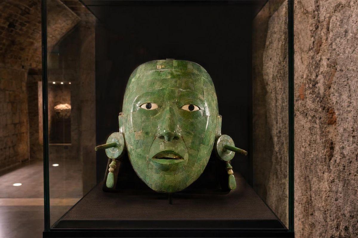
Under Yuknoom Ch'een II, Calakmul installed and supervised kings at cities such as Cancuén, Dos Pilas, El Perú and Naranjo, and its alliances encircled Tikal. The defeat of 695 broke that grip. A tomb in Structure II has been linked by many researchers to Yuknoom Yich'aak K'ahk', the king defeated that year, and it held a jade mosaic mask now displayed in Campeche city.
What to see at the site
Structure II
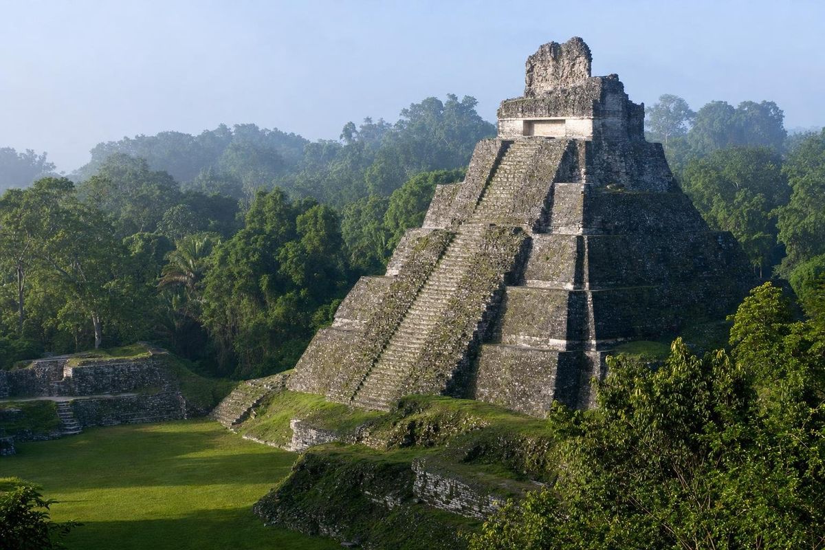
Structure II is the giant on the south side of the Central Plaza, one of the largest buildings the Maya ever raised, roughly 45 m tall with a huge base. Its core goes back to the Preclassic, and later rulers enlarged it in several phases. Visitors can climb to the top, and the view over unbroken forest, with the summit of Structure I rising to the east, is the image most people take home.
Structure I
Structure I, on the east side of the site, is of similar height and also open for climbing. It is steep and the steps are uneven, so take care, especially after rain.
Stelae and the Great Acropolis
Calakmul has more stelae than any other Maya site, over 100 recorded. The local limestone is soft, though, and most are badly eroded, so the inscriptions that rebuilt its history came largely from other cities and from painted ceramics. Several stelae still stand in pairs in front of the buildings, often a king and a queen facing each other. The Great Acropolis, a residential and administrative complex, lies north of the Central Plaza.
The Chiik Nahb murals
In the Chiik Nahb complex north of the core, archaeologists uncovered painted walls showing people selling and preparing food and goods, with captions naming the products. They are among the very few Maya paintings of everyday trade. They are generally not open to visitors, but the finds are covered on the page about the Calakmul museum and its finds.
Wildlife in the reserve
The forest is part of the Selva Maya and one of the best places in Mexico to see wildlife without trying. Spider and howler monkeys are common around the ruins. Ocellated turkeys, with bronze and blue plumage, walk the paths, and toucans, parrots and trogons are frequent. Tapirs, peccaries and jaguars live in the reserve but are rarely seen. Driving the access road at dawn or dusk gives the best chances, slowly.
How to get to Calakmul
The turnoff is on Highway 186, the road between Escárcega and Chetumal, roughly an hour west of Xpujil. From the highway a narrow paved road runs about 60 km south to the site, through a reserve gate and past a small museum. Allow well over an hour each way for that stretch alone. From the parking area it is a walk of a kilometer or more through the forest to the main structures.
Most visitors stay in Xpujil or in eco-lodges along the highway, and combine Calakmul with smaller sites such as Xpuhil, Becán and Chicanná. There is no public transport to the site, so you need a car or a tour.
Practical notes
- Start early. The forest is cooler in the morning and the animals more active.
- Bring plenty of water, food, insect repellent and a hat. Services inside the reserve are very limited.
- Fill the tank before leaving the highway. Fuel stations are scarce in the region.
- The wet season, roughly June to October, brings heavy rain and many mosquitoes; the dry months from about February to May are hot but easier.
- Entry is charged separately for the biosphere reserve and the archaeological zone, and hours change. Check locally before the trip.
For other Maya cities, see the Maya ruins section. From the summit of Structure II on a clear morning, the forest runs on unbroken toward Guatemala, with no road or village in sight.
Balamkú, on the highway between Xpujil and the Calakmul turn-off, is worth a stop on the way: a small site whose building shelters a long painted stucco frieze of frogs, crocodiles and seated figures, read by researchers as a scene of the underworld and royal rebirth.
Calakmul questions
Who were the Snake Kings of Calakmul?
The Kaanul dynasty, named after the snake head in their emblem glyph. In the seventh century they ruled from Calakmul and led a network of allied cities that rivaled Tikal.
Can you climb the pyramids at Calakmul?
Yes, Structure II and Structure I have generally been open for climbing. Rules can change, so check at the site.
How long does it take to reach Calakmul?
From the turnoff on Highway 186, the access road is about 60 km and takes well over an hour. From Xpujil, plan on around two hours each way including the highway.
Is Calakmul a UNESCO World Heritage site?
Yes. The ancient city and the protected forests around it are inscribed together for both cultural and natural value.
What animals can you see at Calakmul?
Spider and howler monkeys, ocellated turkeys, toucans and parrots are common. Tapirs and jaguars live in the reserve but are rarely seen.
Nearby on the map
AI-generated image Museums · Campeche
Calakmul museums
AI-generated image Maya Ruins · Campeche
Xpuhil
AI-generated image Maya Ruins · Quintana Roo
Kohunlich
AI-generated image Maya Ruins · Quintana Roo
Dzibanché